

The Strait of Hormuz is not an area that a coastal State can legitimately transform, through threats, into a controlled transit corridor or even subject to tolls. Under the United Nations Convention on the Law of the Sea, the legal concept of reference for Straits used for international navigation is that of “transit passage,” and the treaty text specifically identifies this regime as a prerequisite for the extension of the territorial waters of coastal States in such Straits. The same body of treaties, in Part III dedicated to such regulations, clarifies that the relevant provisions concern “Straits used for international navigation.” This is important because the current crisis, triggered by the surprise US and Israeli attack with the Epic Fury and Roaring Lion Operations launched on February 28, 2026, should not be described as a legitimate Iranian or US geopolitical ambition to control transit in that stretch of sea, but rather as an attempt to impose dominance over a Global Common (Global Common Good) through coercion and the threat of risk, rather than by virtue of legally recognized territorial control.
Iran has not acquired a legal “monopoly” over the Strait of Hormuz, but it is demonstrating an effective local maritime interdiction capability, exercising coercive control over a strategically important global area. The legal basis remains unchanged: according to the United Nations Convention on the Law of the Sea, Straits used for international navigation are governed by the right of transit, not by arbitrary closures or illegal toll demands. The International Maritime Organization has reiterated that rights and freedoms of navigation through the Strait must be respected, and in its extraordinary session of March 2026, condemned threats and attacks against merchant shipping and the alleged (de facto) closure of the Strait. The Iranian regime’s attempt is to impose formal sovereignty through effective interdiction power. Iran does not need to “own” the Strait in a legal sense to keep it under operational control. The physical configuration, the geographical boundaries limiting passage, the seabed morphology, the islands and mountains delimiting the Strait of Hormuz, strongly favor those who want to destabilize it. In its narrowest transit area it is about 34 kilometers wide, while the established navigation route in each direction is only about 3 kilometers wide, separated by a 3-kilometer buffer zone. This means that commercial traffic is not simply concentrated but channeled into predetermined corridors, similar to airways regulating civil flight flows in airspace. Oil tankers, container ships, and LNG carriers cannot zigzag tactically like small boats or military vessels, nor can they systematically abandon established minimum traffic separation distances without increasing the risk of collision, insurance exposure, and legal liability. In this scenario, a State or proxy actor equipped with missiles, drones, mines, fast patrol boats, boarding capabilities, and coastal sensors does not need complete naval supremacy to paralyze traffic: it only needs the credible threat of selective loss infliction.
This is why the current crisis has transformed the Strait of Hormuz into a hybrid warfare instrument through vulnerability deterrence, rather than due to a classic military blockade that the United States is preparing to implement.
The US Maritime Administration issued a navigational warning in March 2026 concerning the Persian Gulf, the Strait of Hormuz, and the Gulf of Oman on the risk of Iranian and proxy attacks against commercial vessels. These risks are corroborated by the International Maritime Organization (IMO), which since February 28, 2026, has confirmed 21 attacks against commercial ships, with 10 seafarers deceased, several injured, and about 20,000 civilian seafarers in critical condition still aboard hundreds of ships blocked and anchored in the Gulf. The IMO condemned the attacks and called on the international community to ensure safe maritime navigation and coordinated evacuation and transit agreements. These are clear official indications that the crisis is serious and will be prolonged: the danger in the Strait is such that the main United Nations maritime body treats it as a genuine navigation security emergency.
MARITIME ROUTES AND ENERGY COERCION
The energy dimension of the disruption of maritime traffic in the Gulf explains why the global economic impact is so strong. According to the US Energy Information Administration (EIA), the Strait of Hormuz transported about 23.2 million barrels of oil per day in the first half of 2025, equivalent to about 29% of global seaborne oil trade, and remains the most important mandatory maritime bottleneck in the world for maritime and land trade. Hormuz is demonstrating its geopolitical and strategic importance, as the continued inoperability can paralyze global supply chains, especially energy ones. The EIA also estimates that in 2024 about 84% of crude oil and condensate and 83% of LNG transiting through Hormuz were destined for Asian markets. In other words, this is not a regional inconvenience, but a compression point in the circulatory system of the global economy. As soon as commercial operators believe that even a few ships in transit might be threatened, delayed, manipulated, blocked, or even attacked by malicious actors, the market impact cascades through freight rates, insurance premiums, delivery schedules, fleet planning, refinery operations, and global strategic decisions on oil and LNG.
The most important strategic point is that the vulnerability of maritime routes depends on the capacity to control maritime access, which in Straits is rooted in geography, international law, commercial maritime transport practices, and, in the case of Hormuz, conflict escalation management. A Gulf State, even if aided by allied naval forces, can protect some ports, intercept most drones (but not all), and escort some ships for a certain period, but cannot guarantee the safety of every merchant ship transiting through a narrow, internationally shared passage, heavily monitored and under threat of missile attacks, drone swarms, and mines. The defender must protect 100% of ships docking and transiting; the attacker only needs occasional successes, or even almost credible successes, to keep insurers, shipowners, captains, and especially hydrocarbon, energy, and critical material prices under pressure. This asymmetry grants power to the coercion of “Choke Points.”
Saudi Arabia and the United Arab Emirates possess some bypass infrastructure, but it is estimated that only about 2.6 million barrels per day of combined reserve capacity from Saudi and Emirati pipelines could be used to circumvent the Strait in case of disruption. However, the volumes normally transiting through Hormuz are far greater. Saudi Arabia’s East-West pipeline and the UAE’s pipeline to Fujairah can reduce damage but cannot replace the Strait. There is a partial bypass for some crude oil, but no complete bypass for the entire flow of oil and gas through the Strait, and dependence on LNG remains particularly acute. This means that bypassing the Strait cannot be the solution. A choke point is not strategically dominant just because ships fear an attack; it is because upstream export systems begin to fill, clog, and interrupt production. Once upstream production is reduced by downstream maritime blockade, the bottleneck is no longer just a transit problem. It is a production governance problem involving multiple States simultaneously, demonstrating the Strait’s coercibility in systemic terms. To this production reduction must be added the damage caused by military attacks on major extraction infrastructures and refineries throughout the region. This logic analytically explains why Iran has not closed the Strait, but the war unleashed by the USA and Israel has put Hormuz under siege. A total and hermetic closure would imply the absence of transit and a stable control architecture. The current context instead describes a more ambiguous but still dangerous situation: attacks on infrastructures, threats, seafarers unable to depart, maritime route limitations, and a drastic reduction that has turned into a de facto blockade of crossings, as the risk has become unsustainable. The EIA states that after the military action started on February 28, 2026, most maritime traffic ceased transiting the Strait due to the risk of physical damage from Iranian attacks, while the IMO describes ships unable to leave the region and urges humanitarian support and coordinated passage mechanisms. The reality, therefore, is not that of a military maritime blockade: it is selective coercive paralysis.
HOW THE GULF’S GEOGRAPHY AFFECTS THE CONFLICT
The region’s geography profoundly impacts geopolitics by determining the capabilities, vulnerabilities, and power strategies of States. Physical factors such as natural borders, resources, climate, and sea access condition international relations, expansion directions, and alliances, imposing limits or offering strategic advantages to a nation’s policy.
The logic behind the post-kinetic paralysis of the Strait of Hormuz is multifaceted. Coastal anti-ship systems transform geography into large firing zones. The reason Hormuz is so vulnerable is not simply its “importance” for the type of maritime traffic transiting it, making it the world’s most important Strait. The reason is that geography restricts maneuver options to such an extent that it amplifies coercion. Three important choke points for oil trade are located around the Arabian Peninsula, described in a 2017 report by the US Energy Information Administration. At its narrowest point between the two coasts, Hormuz is 21 miles wide, while the navigation route in each direction is only two miles wide, with a two-mile buffer zone between them. A structurally decisive limit because navigation route planning cannot be changed. The same EIA analysis also notes that Hormuz is one of the world’s most important choke points because some Nations have no practical alternatives. Strategically, Hormuz is not simply geographically narrow: the naval traffic that must cross it is obligatorily and functionally channeled. This channeling has several consequences often overlooked. A Very Large Crude Carrier (VLCC), giant supertankers with a gross tonnage between 150,000 and 320,000 tons, or an Ultra Large Crude Carrier (ULCC), the largest tankers ever built, with gross tonnage exceeding 300,000-320,000 tons, as well as large LNG carriers, do not behave like a frigate or a missile patrol boat. They have draft constraints (often over 24 meters), turning radius, stopping distance, collision prevention obligations, specific piloting characteristics, traffic separation, and commercial rules that penalize their navigation and maneuvering capabilities. When traffic is compressed into recognized lanes, the ship’s position becomes more predictable, its maneuvering margin shrinks, and the time window during which a shore observer or missile battery can generate a targeting solution widens. The problem is not that every ship is easy to sink. The risk is that every ship is easy to locate in a narrow and predictable corridor. Coercive control of a choke point begins with predictability and ends with the catastrophic consequences of potential damage and/or sinking of vessels over 350 meters long, loaded with hazardous and highly polluting cargoes. Iran does not need to create an impenetrable anti-access shield in the classical sense of great powers. It only needs to make commercial passage sufficiently uncertain so that routine transit ceases to be such.
THE MILITARIZATION OF HORMUZ
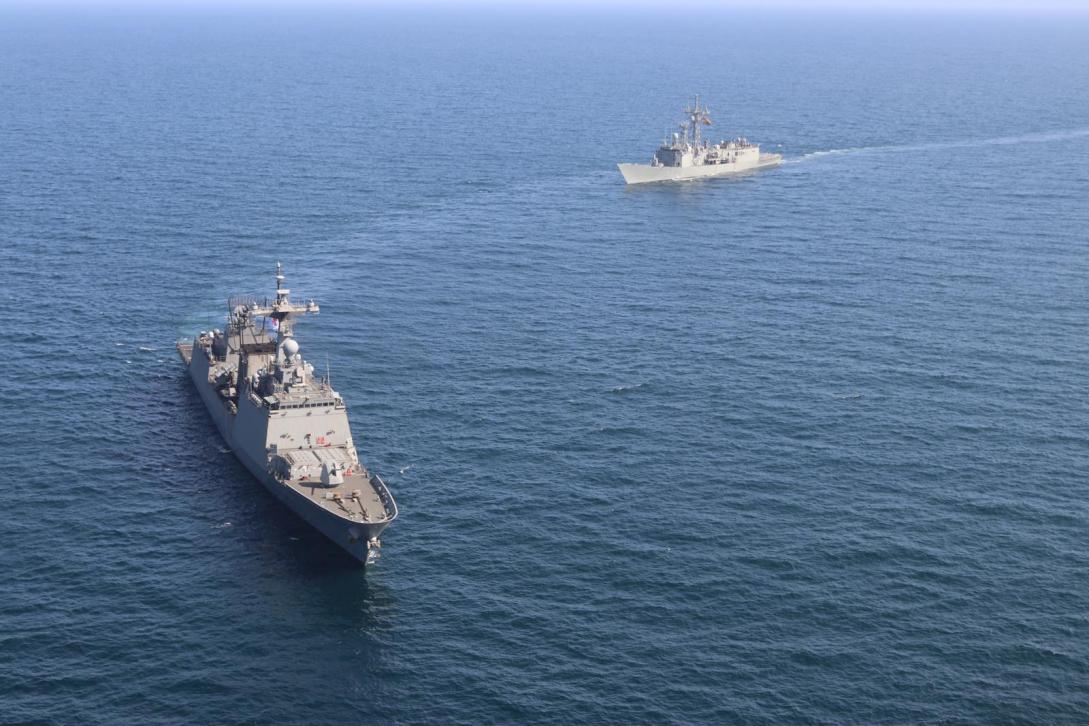
The fear that sea lanes may be mined imposes unsustainable delays, as even a simple doubt about the presence of mines requires clearance, verification, and route control operations. Moreover, fast boats and boarding threats are not so important for sinking every single ship, but to demonstrate that the Iranian State can physically impose its will within the route. Furthermore, GNSS disruption and spoofing, explicitly cited by the IMO Council, compromise navigation reliability precisely in waters where precision is most important. The IMO Council has specifically warned that navigation through the area is affected by disturbances and extensive interference and spoofing of global satellite navigation systems. This is a crucial operational factor because the Strait’s risk is not only kinetic. A physically intact but electronically disoriented ship in heavy traffic, in a narrow route, under wartime threat is already under partial coercive control. The official maritime system is designed around certain maximum error limits in routing, because collision prevention and safe navigation require traffic concentration within defined operational standards. This is why the international routing framework is important. The current crisis has thus created a situation where the commercial map and the threat map overlap almost perfectly. The US Maritime Administration has ordered US-flagged ships to maintain a minimum safety distance of 30 nautical miles from US military vessels and to respond to VHF calls from coalition naval ships and command centers, closely coordinating navigation planning as provided by the NAVCENT NCAGS 2026-004 document, on Iranian attacks on commercial vessels in the Persian Gulf, Strait of Hormuz, and Gulf of Oman. This notice reveals an extremely complex scenario logic: merchant traffic must avoid hostile attacks, and at the same time, must also avoid being mistakenly identified as enemy, remaining integrated with maritime identification procedures of coalition naval forces and areas. In a crowded corridor, subjected to electronic stress and characterized by military escalation, the cost of transits through the Strait increases drastically even when a ship is never actually hit. Interference in navigation and communication systems reduces confidence, slows the commander’s decision-making process, lowers separation standards ensuring deconfliction with US Navy military ships, and increases the likelihood that a merchant captain refuses to cross that area without the IRGC firing any missiles.
The geopolitical and economic implications are evident. There is no single “route” that makes merchant maritime transport invulnerable, because the problem is not only route choice, but the combination of narrow and predictable passages, limited bypass capacity, persistent attack risk, navigation system interference, and escort constraints sensitive to escalation. Oman and the United Arab Emirates are not irrelevant or passive, but alone they cannot transform an internationally threatened choke point into a risk-free normality. Restoring normal transit does not require the courage of a single actor, but a coordinated regime of naval protection, de-escalation, mine clearance readiness, secure communications, sustainable coverage by insurance companies, and above all, political de-escalation. Official maritime agencies are effectively stating precisely this: military measures alone are not enough and freedom of navigation cannot be restored with rhetoric.
THE INFORMATION WAR
Iran’s power in Hormuz lies in its ability to transform legal transit into risky irrational transit. Once this happens, traffic separation, hydrography, insurance, fleet planning, export storage, and global prices all begin to favor those exercising coercion. Iran can exert extraordinary influence in the Strait of Hormuz not because it has acquired legitimate sovereignty over the passage, nor because it can guarantee the destruction of every ship, but because the legal and safe opening of the Strait coexists with a hydrographic structure that, under current conditions, compresses traffic into narrow and predictable lanes that make vessels easy targets.
The information war multiplies the deterrence effect: uncertainty about route safety, supply and stock availability times, and the credibility of a truce can paralyze navigation with the same effectiveness as a kinetic attack. In this model, the goal is not the annihilation of all traffic, but the replacement of routine navigation with passage politically conditioned by Iran.
The official version communicated by the White House on April 8, 2026 was not that the crisis had disappeared, but that “Iran has now accepted a ceasefire and the reopening of the Strait of Hormuz,” in the context of a broader peace negotiation. The same White House statement also said the operation lasted 38 days and cited senior officials describing it as a four-to-six-week military operation. So: the US government’s narrative presents a declared ceasefire and a planned reopening, not a full restoration of normal maritime conditions.
A NEW “TRUMP MATRIX” EPISODE?
The war information context in which the White House’s victory messages and operational maritime ones proceed in different directions and speeds. Washington, with its statement “Peace through strength: Operation Epic Fury crushes the Iranian threat with the ceasefire taking effect April 2026,” emphasized that the campaign had achieved its objectives and that Iran had accepted a ceasefire and the reopening of maritime routes. The less speculative interpretation is not that part of the statement is entirely fictional and the other entirely truthful, but that the political assertion of “reopening” occurred without the maritime system being able to certify safe and regular transit.
Regarding the specific claim through which President Trump “threatened the annihilation of Iranian civilization,” what can be observed is that, due to difficulties in pursuing its objectives, the White House is using extraordinarily maximalist and unprecedented language regarding this campaign. On March 1, 2026, Washington